Saguaro National Park
  Home   pixel   Store   pixel   Maps
Directions
  pixel   Visitor
Centers
  pixel   Scenic Drives   pixel   Trail
Favorites
  pixel   Picnic Areas   pixel   Camping
Lodging
  pixel   Nearby
Attractions 
         
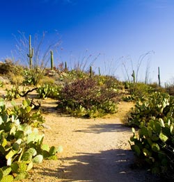
Tanque Verde Trail Saguaro National Park West Photo
© Jim Roth

Tanque Verde Ridge Trail
in Saguaro National Park East

The Tanque Verde Ridge Trail is narrow, rocky, and steep, with spectacular views of the Tucson Basin. The trail travels through a wide variety of plant and animal habitats. As the trail gains elevation, the plant communities gradually change from desert scrub and desert grassland to oak/pine woodland. Tanque Verde Peak, 2.1 miles east of Juniper Basin Camp, is the highest peak in on the Tanque Verde Ridge at 7040 feet.
(Saguaro National Park Text)

Wasson and Amole Peaks Saugaro National Park West
© Jim Roth

Amole Peak in middle and Wasson Peak is far left. This photo was taken from the Ez-Kim-In-Zin Picnic area in the middle of the park.


Favorite Trails

Saguaro National Park has many interesting trails to hike in both the Eastern and Western districts.

I give you my two favorite trails one in Saguaro East on the left and one in Saguaro West on the right.

Both of these trails can be hiked as a short one or two mile hike with great views. The Tanque Verde Ridge Trail is the major route into backcountry camping in Saguaro East. The King Canyon Trail connects with other trails to allow you to climb Wasson Peak the highest peak in Saguaro West.

Remember you will find no water on any trails in Saguaro West and water in Saguaro East is spotty and usually only at Manning Camp (check at the visitor center for backcountry permits and water conditions at Manning Camp) which is a 16 mile hike one way and an elevation gain of over 4,000 feet. Please be aware of this when planning how far to hike.

Trails in Saguaro West
(136kb pdf file)

Short Trails in Saguaro East
(263kb pdf file)

Long Trails in Saguaro East
(69kb pdf file)


King Canyon Trail Sagauro National Park West Photo
© Jim Roth

King Canyon Trail
in Saguaro National Park West

The first section of the King Canyon Trail follows an old roadway constructed by the Civilian Conservation Corps in the 1930s. At 0.9 miles hikers pass the Sendero Esperanza Trail junction near the Mam-A-Gah picnic area, named for a Tohono O'odham Indian Chief. The final section ascends a series of switchbacks to the Hugh Norris Trail to reach the top of Wasson Peak, the highest point in Saguaro National Park West.
(Saguaro National Park Text
)


Tanque Verde Ridge Saguaro National Park East
© Jim Roth

Tanque Verde Ridge Photo

Saguaro National Park
Home
 | About Us  | Privacy Policy | Contact Us |  Site Map
©2006-2019. All rights reserved. This website is not associated with the National Park Service or any Government Agency.