Directions
Centers
Favorites
Lodging
Attractions
| Saguaro National Park |
| Home | |
Store | |
Maps Directions |
|
Visitor Centers |
|
Scenic Drives | |
Trail Favorites |
|
Picnic Areas | |
Camping Lodging |
|
Nearby Attractions |
Bajada Loop Drive Pictures |
||
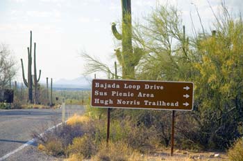
This is the first entrance to the Bajada Loop Drive when driving North from from the Red Hills Visitor Center on Kinney Road.
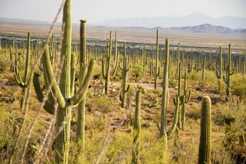
The view above is to the West from the Sus Picnic area. It is in a thick Saguaro forest.
View of Amole Peak in the center of the photo and Wasson Peak is far left. Photo was taken at the Ez-Kim-In-Zim Picnic area. |
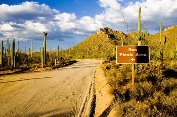
This is what the unpaved graded road looks like at the Sus Picnic Area turnoff on the Bajada Loop Drive. The Bajada Loop drive is one way from this point.
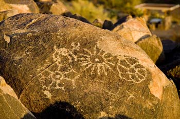
Go to the Signal Hill Picnic area and take the 1/4 mile Signal Hill Trail to see Petroglyphs.
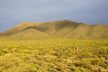
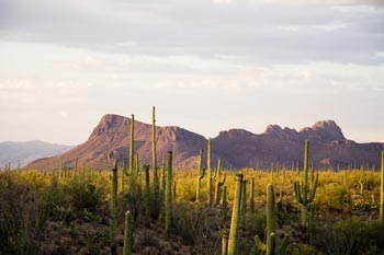
A view of Panther Peak (left) and Safford Peak (right) taken from Signal Hill in the Signal Hill Picnic Area. These mountains are at the far northern boundary of Saguaro National Park West. If you continue on Golden Gate Road past the Ez-Kim-In-Zin picnic area you get a great sweeping view of these mountains and the surrounding desert.
|
|